
I grew up in the north. You know, dry air, snow, and swimming in ponds when it’s 68°F because that’s hot already. I’m also very, very white—my dad used to describe me as pale as death. All these things considered, running the trails around Mount Tantalus (Pu’u Ohi’a) in Hawaii was certainly a great idea.
I look up to a few runners and many races. One of these races is the HURT 100. Running the course has never even crossed my mind; it’s far away, it’s rugged, it’s steep, and it’s definitely way out of the scope of my skills. In comparison, running the course of Western States, over the period of several days, sounds like a walk in the park. I’m comfortable in the Sierras and have done two ultramarathons around Auburn and Cool. (Now watch me attempt it and get proven completely wrong.)
Before I get any further, I want to talk about HURT for a bit. But as I haven’t had the honor to be present for the race (I do hope to volunteer it one day), I’d like to turn your attention to ROOTED, a fantastic docu-film about HURT, its founders, its origins, and its great, gorgeous, gnarly trails. The way HURT came to be is truly heart-warming and this documentary makes me tear up no matter how many times I watch it.
Now that we’re all up to speed, let’s get back to my attempt to do even a single loop of this course. One loop is 20 miles. Spoiler alert: that’s really bloody far on these trails and (for me) in this weather. Remember where I’m from? Yeah. I got sunburnt after 10 minutes in the sun the day before I ran so my shirt and vest were rubbing my burnt shoulders raw. The humidity is like nothing I’ve ever run in; I felt like I could drown in the air. And oh my, the heat… unspeakable.
After an early rise and an Uber ride, I started just below the Hawaii Nature Center and picked my way up the slopes of Pu’u Ohi’a, or Mount Tantalus. I realized I’d gone the wrong way about half-mile up the trail but decided to continue and just do the lower part of the course in reverse. (In the end, I learned the hard way why it’s run the way it’s run and not in the opposite direction.)
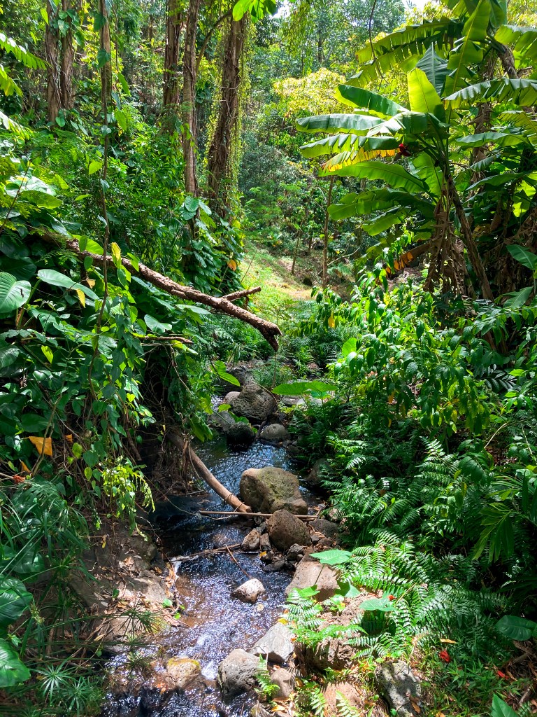
Sweat was pouring down the sides of my face in rivers by the time I reached the Kanealole Valley/Makiki Valley Trail junction, about 1.5 mile from the start. A man was washing his face in the Kanealole Stream and I felt compelled to join him—indeed, to submerge myself fully in the waters of Makiki Springs, proclaim the whole thing a mistake, and get back to the coast where the air felt drier and where some breeze was always present, making existence a much more pleasant experience.
My pace was about zero-zero-nothing because a) it was mostly uphill but more importantly b) I was stopping about every twenty yards to adore one thing or take photos of another. Moleka Trail brought sections of bamboo groves so tall and thick it looked like twilight had come some 10 hours early.
I finally crossed the road and joined the Manoa Cliffs Trail, passed a few hikers on the narrow path that wound around the steep hillside, and enjoyed the mellow ups-and-downs of the trail and the occasional technical section that came up. Soon, I reached a point of the trail that got a variation of “Oh my god, this is so gorgeous!” about every two minutes or less. And no wonder; the view opened up and before me were the steep slopes of (my best guess) Mount Olympus, Manoa Middle, and Kōnāhuanui (K2).
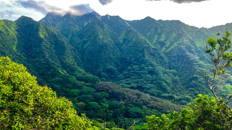
The views kept getting better and better, and even though the trail was beautifully runnable, I didn’t really run much of it. Staring off into the distance at the mountains and running along a steep cliffside where one misstep means a long, most likely deadly tumble, don’t really go together.
I soon reached a gate that led me into a conservation portion of the trail. The sign asked that no vegetation be cut, presumably not even for trail maintenance purposes. It was gorgeous; the trail got lost in the greenery as I wound through a hundred different kinds of plants, running through leaves the size of half of my body.
From the next junction on, the trail got rootier. A part of the Pauoa Flats Trail had a wooden plank walk on the side, probably to make it easier to traverse all the roots. I felt a bit safer on the roots tho, as the walk was quite wobbly and seemed to have been there for quite some time. The last thing I wanted was to fall through one of the planks, twisting my ankle or worse.
Speaking of twisty ankles; thank god for my strong ankles. I turned each of my ankles several times during this run, and had they been a bit weaker, at least one of those twists would have definitely guaranteed a helicopter ride out of the preserve.
Pauoa Flats brought me to Aihualama Trail and I started the descent to Manoa Falls. I reached *The* Section of the trail pretty soon. By *The* Section I mean a section of the trail that is only about 5% trail and 95% root. It doesn’t even look like a trail. If I didn’t know it from my friends’ stories and ROOTED, I would have thought the trail just evaporated under my feet.

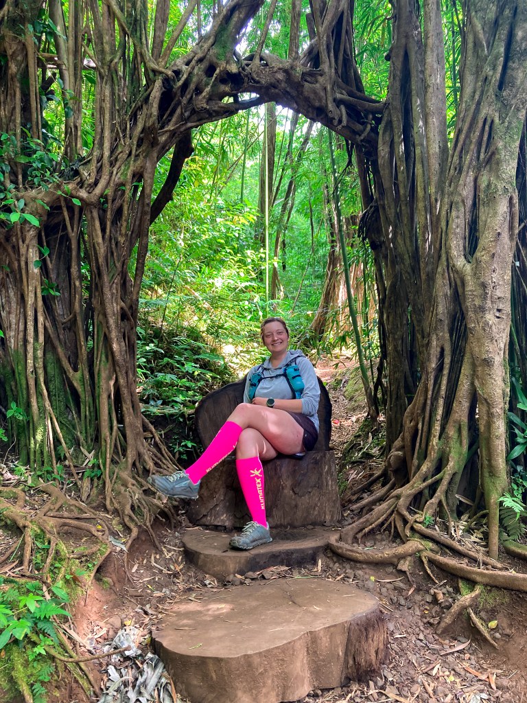
There were three gigantic banyan trees, bigger than any other banyans I’ve ever seen, and just past them, the trail, albeit still quite technical and with a few bigger drops, became runnable again.
I realized that no sane person who’s supposedly on vacation would do this (‘this’ being run all over Round Top Preserve) when several people thought I was a local because, once again, no sane person would do this during their vacation.
And I realized that I made myself look more like someone who’s lived here for a bit when I was able to tell two tourists how far they were from Mount Tantalus and describe the way there in detail, including one open gate, one closed gate, wooden plank walk with a warning because it’s a bit wobbly, three wrong turns, two correct turns, and more. That was my first day out in the preserve, and I have studied the map only a bit. Fun fact: I got lost in the Ala Moana mall later that day.
I made a quick and fun job of going down to Manoa Falls. Or, well, the place where the falls were supposed to be. It seemed somebody turned off the water, as there was barely a trickle coming down, not fully visible. And it also seemed a few people needed to go back to elementary school, as several tourists were at the bottom of the fall, well past a sign that prohibits entry and a barrier for those who can’t read.
I ran down to the trailhead where I found a bathroom, which was perfect for several things, but mainly to reapply SNB literally everywhere I could think of and to refill my water bottles. I pushed down some food, took a photo of a family who, in turn, took a photo of me, and then I headed back up the way I came down; a feat I was dreading… well, I was going to say “the whole time I was coming down” but that wouldn’t be correct, as I had moments when I just genuinely enjoyed the downhill without thinking about anything.
I met the couple whom I gave directions at the top of the trail.
“Made it to Tantalus?” I asked them.
“Yeah, thanks again for your help! You going back out?”
“Unless you can give me a ride back home, I have to!”
Somehow, my legs gained a new-found strength on that uphill and it felt easier than anything up until that point. About halfway up, I met a family of about ten people whom I also met on my way down Aihualama Trail. As it turned out, they remembered me.
This favourite interaction of mine happened in two episodes. On my way down, first meeting, it started with the obligatory “Is something chasing you?” from what I presume was the dad of the group.
“Yeah, yeah!” I laughed. “If you see me running, you better run, too!”
No more than 5 seconds later, the uncle came around with the second half of the family and couldn’t help but be as original as the dad: “You running from something? There a jaguar up ahead?”
That was the first part of our conversation. The second half happened during my return. They were just descending the trail back to the trailhead. They recognized me instantly, even though it took me a second to realize I’d seen them on their way up.
Dad: “Wow! You’re going back up again?”
Me: “I started on the other side, I have to, to get home!”
Uncle: “Oh my god.”
Son/nephew: “Dude’s going back up?!”
Apparently, I was promoted to a “dude” thanks to the ridiculousness of my endeavor.
I backtracked my steps on the now-familiar trails, making the difficult decision not to go down to Judd trail and, therefore, skip one part of the HURT 100 trail. The truth was, I was running out of juice, and so were my watch and phone. I relied on my phone to call for help should something happen to me; I had nobody to expect me at home, and nobody knew where I was. My HR was up in the 180s from simply hiking uphill and my head didn’t feel so great, either. I downed a salt tab, a gel, and kept going.
Soon, I was back on Manoa Cliffs Trail. It was time to whip out the headphones; I loved listening to the sounds of the jungle but “Wheels on the bus go round and round…” had been playing in my head on repeat for about half-hour and I was starting to lose my sanity.
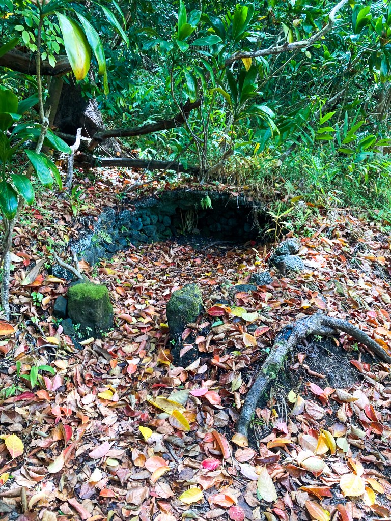
Kalawahine Trail took me past a little structure the origin and purpose of which remains a secret to me, around walls of volcanic rock overgrown with greenery, and under a continuous cover of trees. I brought sunscreen with me but I didn’t need to use it; the greenery kept the sun off me for most of the day.
A short road section offered a glimpse at Honolulu and the ocean, only the second viewpoint of the day. Which, in retrospect, was probably a good thing; as we’ve already established, views and technical trails aren’t the best combination for someone as easily distracted as me.
Nahuina Trail Brought me back to Makiki Valley Trail, the second running of that section. I stopped at the stream where I saw the man in the morning and washed my face. It felt like heaven, and I think I might have experienced Nirvana at that point. I also refilled one of my bottles there to drink “in an emergency” because I was running out of water pretty quickly and could chug about a liter at once.
About halfway through the section, my body decided we’d had enough for the day and I experienced a mini-bonk. I wobbled and hobbled to the next trail junction where an elderly couple was resting.
“You look like you need a break!” the man called out.
“You know, that doesn’t sound like a bad idea!” I replied.
Two minutes later, I felt better and embarked on the last section; a descent via Maunalaha Trail.
Do you remember when I said that I learned the hard way why the HURT 100 course is run the way it is and not in reverse? Yeah. Running down the trail proved nigh impossible. I managed to scramble for a bit, every single muscle on my legs was on fire, trying to keep us upright. A few times, I had to go backward. My legs were tired and I was a bit scared, to be honest.
But at the same time… come on. This was supposed to be fun! So, eventually, I negotiated with my legs and we started dancing down the rocky, rooty trail. Small steps, sure footing, and it all eventually came together, although the amount of constant focus it required was so big I completely missed a full family of hikers until the mum called out: “You’ve got this down, you’re so fast!”
I didn’t feel fast, and I didn’t feel like I had it 100% down—but I was surely enjoying the deep focus descending the trail at that pace brought. Before I knew it, I was back at the trail junction where I took the wrong turn some six hours earlier. (Yes, altogether, I took some 6 hours to do 15 miles. When counting only moving time, it was 5 hours. But who counts only moving time? I wouldn’t make it past the first cutoff at HURT 100, if I got to it at all!)
Water fountain! I made it to the Hawaii Nature Center and drowned my stomach in water. It didn’t matter that it was coming out of the fountain hotter than what I shower with; it was water, and I was thirsty.
I called an Uber and settled on a giant rock; I wasn’t going to make it the 2.5 miles on pavement back home. The arch on my left foot was shot (later that day, I got a terrible cramp in it) and frankly, I didn’t want to move another inch unless I absolutely had to.
In the evening, I went to take a swim in the ocean at sunset. It was gorgeous. Until… well, I thought (and was ecstatic, in fact) that I didn’t chafe during the run. Oh, how wrong I was—and the ocean happily showed me exactly how wrong I was and to which extent and in how many places I’d chafed!

One thought on “HURT Trails Hurt: A Northener’s Stab at the Round Top Preserve Trails on Oahu, Hawaii”